The Boulder area offers a wealth of hiking trails. You can stroll through the prairie grasslands of east Boulder, climb the rising foothills and canyons of the west, and explore alpine treasures in the high mountains.
 Below we've listed some of our favorite local hikes. However, we'd first like to share a couple of notes for hike-loving visitors.
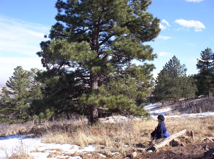
The town of Boulder starts at 5,300 feet above sea level. Some in-town trails climb to 7,000 feet or higher, and mountain trails often rise above 10,000 feet. If you're traveling to Boulder from sea level, you might want to give yourself several days to acclimate. Altitude sickness — though uncommon — does affect some visitors.
Also note that despite its urban feel, the city of Boulder is home to mountain lions, black bears, and rattlesnakes. Small children are particularly vulnerable to natural predators. When hiking in groups, please don’t allow kids to stray behind.
Now on to some hiking favorites!
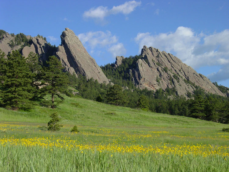
Most flatirons-area hikes begin on the Chautauqua grounds (map). These trails are among the most popular in-town hikes in Boulder.
 For an easy introduction, the Mesa trail (6 miles one-way, relatively flat) provides a gentle tour through the base of the foothills. You can begin at the Chautauqua ranger station — or for a greener beginning, take the McClintock trail spur which starts in back of the Chautauqua auditorium. The Mesa trail runs the entire 6-mile distance between Chautauqua and Eldorado Springs. However, most folks simply stroll until satisfied.
The Royal Arch trail (1.5 miles one-way, 1200 foot elevation gain) is a fun challenge for moderate hikers. Begin at the Chautauqua ranger station, and follow the Mesa trail to the Bluebell shelter. Look for signs pointing you toward the Royal Arch trail. A steep rock-stair section is the toughest part of the hike. The trail ends at a delightfully large sandstone arch, and offers great views of east Boulder.
The First Flatiron trail (1.1 miles one-way, 1500 foot elevation gain) also begins with a gentle ascent to the Bluebell shelter. The trail then weaves between the first and second flatirons, concluding near the peak of the first. If you spend time at the top, you might be able to watch some of Boulder's climbers rappelling off the summit of the first flatiron.
The Gregory Canyon trail (1.1 miles one-way, 900 foot gain) is a nicely sheltered canyon ascent. The trail climbs nearly 1000 feet in a mile, so you’ll get a work-out. Once you reach the top, you can cross over to the Saddle Rock trail and complete a 3-mile loop. Or if you feel particularly strong, follow the Ranger trail to the Green Mountain trail, and climb to the top of 8100 foot Green Mountain (3.3 miles one-way, 2300 feet elevation gain).
The Mount Sanitas trail (3.2 mile loop, 1250 foot gain) is one of the most popular in-town hikes. The trailhead is located slightly west of 4th and Mapleton, a 20 minute walk from the Pearl Street mall (map). It's a bit of a climb, but not overwhelming. You might see some bouldering rock climbers along the way.
The Anne U. White trail (1.5 miles one-way, 500 foot gain) is a lovely stroll along four-mile canyon creek in north Boulder. The trail is an excellent introduction to Boulder-area hikes for folks coming from sea level. To get to the trailhead, take Broadway north to Lee Hill Road. Heading west on Lee Hill road, turn left on Wagonwheel Gap road and left again on Pinto Drive to the trailhead (map). The tree-lined creek provides nice shade in the summer.
If you follow Canyon Boulevard west through Boulder, you’ll be led into picturesque Boulder Canyon. Mid-way up the canyon is Boulder Falls, with a short stroll (.3 miles, flat) to a scenic waterfall.
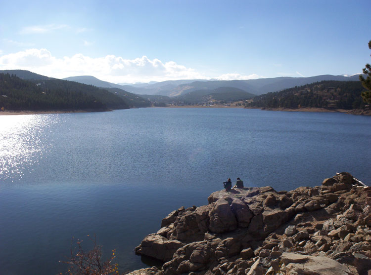 At the top of the canyon you’ll find the mountain town of Nederland. Here you can walk around the beautiful Barker Reservoir (1.5 miles one-way, relatively flat) and enjoy the views of the snow-capped Rockies.
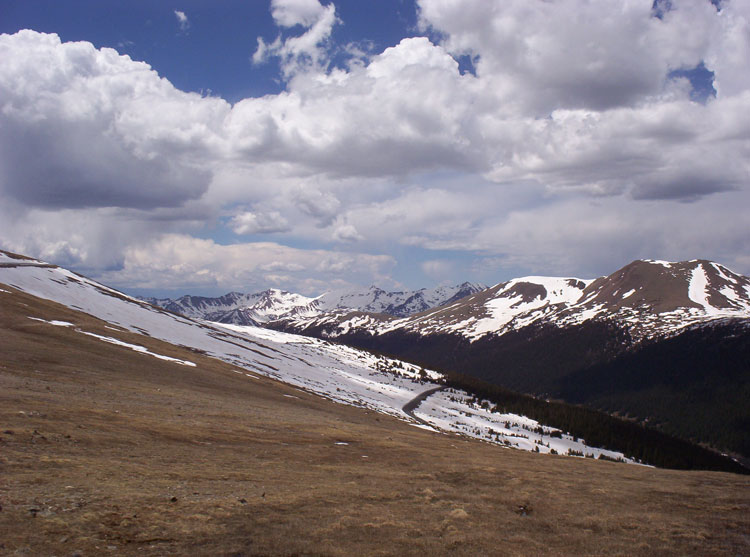
Nearby are a series of lovely alpine hikes. The Lost Lake trail (1.5 miles one-way, 800 foot gain) begins at the Hessie trailhead (map), and climbs from 9000 to 9800 feet. Lost Lake is a beautiful high-mountain lake destination, and the trail is relatively gentle. Note, however, that afternoon thunderstorms are very common in the high mountains. Please plan accordingly.
The Diamond Lake trail (2.5 miles one-way, 900 foot gain) starts at the 10,000 foot Fourth of July trailhead (map). Winding through wildflower-sprinkled hills and forests, the reward of Diamond Lake is lovely. Be aware that the dirt road leading to the trailhead is rocky and narrow. Four-wheel drive or high-clearance vehicles are preferred.
The Brainard Lake area (map) within the Indian Peaks wilderness contains many local jewels. The entrance fee is $16, and a timed reservation is required in the summer. The entrance is located off the peak-to-peak highway between Nederland and Ward.
A stroll around Long Lake (2.5 miles around the lake, relatively flat) offers a gentle introduction to the area. Prepare to be swarmed with mosquitoes when you stop to rest, however.
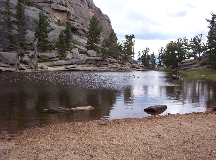
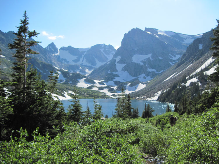 Lake Isabelle (2 miles one-way, 400 foot gain) is one of the finest easy hikes in the vicinity. Beginning with a stroll past Long Lake, the trail branches into a valley. A brief climb puts you at Lake Isabelle, which features lovely wildflowers and traces of snow even in July. If you wish, you can follow the trail along the lake and climb another 1500 feet over 2 miles to the Isabelle Glacier at 12,000 feet.
The Blue Lake trail (2.5 miles one-way, 850 foot gain) begins in a forest, climbs past Mitchell Lake through splashes of wildflowers, and ends at the scenic alpine Blue Lake.
Approximately one hour away from Boulder is the vast Rocky Mountain National Park. The $35 entrance fee gets you a map with details on various hikes. Your pass is good for a week, allowing you to explore the vast RMNP trail system. Please note that timed entry permit reservations (made in advance of your trip) are required from May through October. Below are some hiking options to get you started.
Nymph, Dream, and Emerald Lake trails are among the most popular in the park. All three are located in a sequence in the popular Bear Lake area. (Please note that in the summer, this area requires its own special timed entry pass. Try to book weeks in advance.) Emerald Lake is a 4.1 miles round trip, 744 feet gain trail. You'll reach Nymph Lake after a half-mile, and then Dream Lake after another half-mile. Emerald is one more mile after that. The trail can be a bit crowded at times, but it's one of the best in the park.
If you aren't able to gain access to the Bear Lake section of Rocky Mountain park, there are still options.
 The Toll Memorial/Tundra Nature Trail (.5 miles one-way, 200 foot gain) at the top of the park offers a unique view of an alpine tundra environment — complete with tiny wildflowers, lichen, and picas. Starting at 12,100 feet, this is one of the highest trails in Colorado.
Even on hot summer days, the temperature on this trail can be in the 50° range. Bring some warm clothing! To get there, take Trail Ridge Road to the top (map). An alpine visitor's center is just past the trailhead on Trail Ridge Road.
Ouzel Falls trail (2.5 miles one-way, 1000 foot gain) in the Wild Basin section of RMNP is a favorite. The forested path leads past several cascades to the scenic Ouzel Falls. The trail climbs from 8500 feet to 9500 feet. The Wild Basin entrance to the park is off of Colorado Route 7, south of Estes Park (map). If you're over in that section, also stop by Lily Lake off of Route 7 (map).
 The Gem Lake trail (2 miles one-way, 1100 foot gain) is located near the Lumpy Ridge section of Rocky Mountain park. If you would like to stay fairly close to Estes Park, and prefer a short, slightly steep hike, you might want to try Gem Lake. The trail climbs through hills, past a natural "rock boot" to a tiny, appropriately-named gem of a lake.
Beginning at 7900 feet, this hike has a slightly lower profile than most other Rocky Mountain trails. Access is off County Road 43 in Estes Park (map). You will still need a day pass for this section of the park, though there is no ranger/entrance station. The trail is sunny and largely exposed, so bring plenty of water.
VisitingBoulder.com is edited by Dan Cavicchio, a local author. All write-ups are done by local residents. No compensation was provided by any business featured on this site.
Please also enjoy Dan's free career book, Career Psychology, written from the perspective of a career counselor and executive recruiter. The book is available at FreeCareerBook.com.

Email Dan at: dan.joseph.cavicchio
@gmail.com